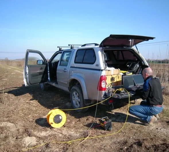
A recent 8-story structure off Loop 1604 hit limestone refusal at uneven depths across just half a city block. The general contractor needed to know why before ordering more piers. In San Antonio, the Glen Rose and Edwards limestone formations don't present a flat top—weathered pinnacles, clay-filled solution cavities, and stair-step faulting are common. That's where seismic tomography becomes indispensable. We run both refraction and reflection lines to image subsurface velocity contrasts, tying them directly to our SPT drilling logs for calibration. Deep alluvial pockets in the Balcones Fault Zone can remain invisible to standard borings alone. Our team deploys 24- to 48-channel arrays with sledgehammer or accelerated weight-drop sources. The resulting 2D velocity sections reveal true bedrock topography. For sensitive downtown sites, we also pair the survey with MASW processing to extract shear-wave velocity from the same dataset, feeding the site classification required by IBC Chapter 16.
Seismic velocity models let us track the limestone surface beneath San Antonio's alluvium without punching a borehole every 15 feet.
Process overview
Local ground factors
ASCE 7-22 Section 11.4 requires shear-wave velocity in the top 30 meters for seismic site classification. A generic site class assumption in San Antonio is risky because the velocity profile can jump from Class D to Class B over a short horizontal distance where limestone rises. Karst features add another dimension: a hidden cavity beneath a spread footing redistributes stress in ways a uniform soil model never predicts. Our tomography surveys map lateral velocity gradients that indicate cavity boundaries or fault offsets. Without this imaging, a project east of I-35 might assign uniform ground motion parameters to a site that actually crosses a Class C/D boundary. The IBC explicitly permits measured Vs profiles in lieu of proxy-based classification. We use the velocity grid from tomography to calculate Vs30 with less spatial averaging than a single borehole’s downhole test provides. For projects near the Balcones Escarpment, we recommend overlapping refraction lines with liquefaction assessment screening in the floodplain silts.
Regulatory framework
ASTM D5777-18 (Standard Guide for Using the Seismic Refraction Method), ASTM D7128-18 (Standard Guide for Using the Seismic Reflection Method), IBC 2021 Chapter 16 (Structural Design – Site classification based on Vs30), ASCE/SEI 7-22 Section 11.4 (Site coefficients and classification)
Additional services
Refraction Microtremor (ReMi)
Passive recording of ambient noise to derive deep shear-wave velocity profiles—useful where active sources can't reach 30-meter depth.
2D Reflection Profiling
Common-offset or CDP gathers across short spreads to image near-vertical fractures and cavity boundaries in limestone.
Integrated Vs30 Mapping
Combine refraction P-wave and MASW S-wave data into a single site-class map, accepted by San Antonio permitting authorities.
Rippability and Excavation Assessment
Velocity-to-rippability charts calibrated with SPT refusal depths to guide mechanical excavation planning.
Typical parameters
Top questions
What's the difference between refraction and reflection tomography for a downtown San Antonio site?
Refraction maps the top of competent rock and lateral velocity changes—ideal for finding the limestone surface depth. Reflection images vertical features like faults and cavities. We usually run refraction as the primary method and add a short reflection spread if the borehole log suggests karst features.
How much does a seismic tomography survey cost in the San Antonio area?
A typical single-line refraction survey with 24 to 48 channels runs between US$2,340 and US$5,070 depending on the spread length, number of shot points, and whether we add MASW processing for Vs30. Longer lines or multi-line grids increase the cost proportionally.
Can you run the survey on a paved parking lot or does it need open soil?
Yes, paved surfaces work. We plant geophones on small putty pads or drill tiny pilot holes through asphalt. The source impact is a sledgehammer on a metal plate—no damage to pavement. Downtown San Antonio sites with limited green space are routine for us.