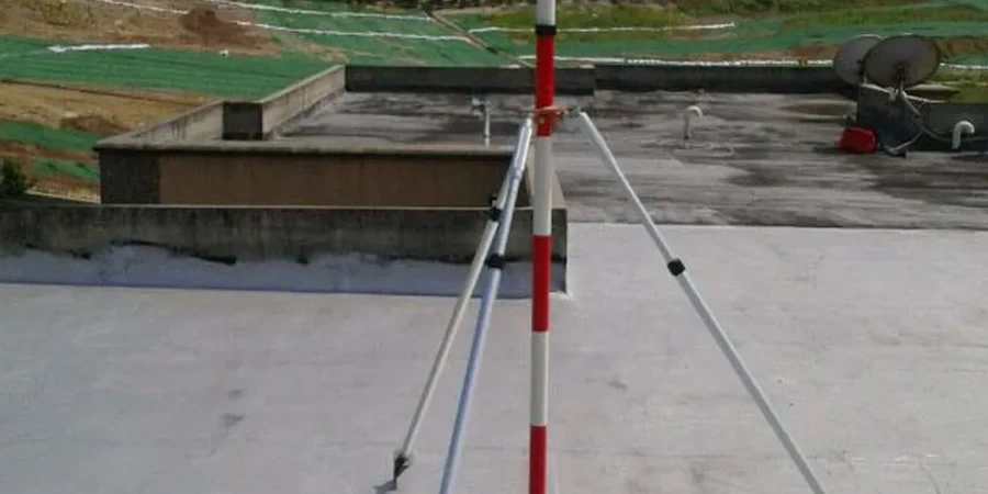
The total station sits on a solid tripod, locked onto a prism target mounted to a soldier pile wall just off Loop 410. That's the daily reality of monitoring a deep excavation in San Antonio. Our field crews deploy automated inclinometers, vibrating wire piezometers, and optical survey markers across active job sites from the Medical Center to the Pearl District. The Balcones Escarpment cuts right through the northwest side of the city, so we deal with limestone ledges one week and expansive clay the next. For cuts deeper than 20 feet near the River Walk, we often pair monitoring data with a CPT test to refine the stratigraphy before the shoring design is finalized. Every reading gets logged against the baseline established during pre-construction, giving the structural engineer a clear picture of what the ground is actually doing.
A monitoring program doesn't just measure movement. It gives the contractor the confidence to keep working when the data confirms the ground is behaving exactly as the geotechnical model predicted.
Process overview
Local ground factors
Something we notice on San Antonio job sites is that groundwater isn't always where the pre-bid geotech report says it'll be. The city sits over the Edwards Aquifer recharge zone, and a few days of heavy Hill Country rain can raise the water table faster than anyone expects. We've seen excavations on the north side go from bone-dry to standing water in under 48 hours. Without active piezometer monitoring, the first sign of trouble is usually a bulge in the shoring or a crack propagating up the street. By then, remediation costs are already climbing. Monitoring data lets the team spot the pore pressure trend early, adjust the dewatering plan, and keep the excavation on schedule. It also provides the documentation that building officials and adjacent property owners want to see when questions arise.
Regulatory framework
IBC Chapter 33 (Safeguards During Construction), ASCE 7 (Minimum Design Loads), ASTM D6230 (Inclinometer Monitoring), OSHA 1926 Subpart P (Excavation Safety), ASTM D7299 (Vertical Inclinometer Probe)
Additional services
Deep Excavation Monitoring Package
Full instrumentation for shored cuts over 15 feet deep. We install inclinometer casing behind the wall, piezometers at multiple depths, and optical prisms on the bracing. Daily automated reports compare movement to the design envelope. Suitable for downtown parking garages, hospital expansions, and transit projects.
Adjacent Structure Protection Monitoring
When your dig is within the zone of influence of an existing building, we instrument both the excavation and the neighbor. Crack gauges, tiltmeters on columns, and settlement points on the foundation track any construction-induced movement. Pre-construction condition surveys document the baseline before the first bucket of soil comes out.
Typical parameters
Top questions
How much does geotechnical excavation monitoring cost in San Antonio?
A monitoring program for a typical San Antonio excavation runs between US$840 and US$2,590 per month depending on the number of instruments, the frequency of readings, and whether automated data collection is required. A simple program with manual inclinometer readings and a few survey points is on the lower end. A fully automated system with web-based dashboards, vibrating wire piezometers, and real-time alerts for a deep multi-level excavation is on the higher end. We provide a fixed-price proposal after reviewing the shoring plans and the geotechnical baseline report.
How often do you take readings during an excavation in San Antonio?
It depends on the project phase. During active excavation near a trigger depth, we typically read inclinometers and piezometers daily. Survey markers on the shoring wall and adjacent structures are measured at least twice a week. Once the excavation reaches final grade and the permanent structure is coming up, the frequency usually drops to weekly or bi-weekly. We follow the monitoring plan approved by the engineer of record, and we increase frequency immediately if any reading approaches the yellow trigger level.
What instrumentation is right for a limestone cut in San Antonio?
Limestone cuts on the northwest side of San Antonio behave differently than clay excavations. In competent rock, we focus on crack meters in the rock face, survey prisms on the crest to catch block movement, and standpipe piezometers if there are clay seams that could hold water. Inclinometers are less useful in hard rock unless there are known fracture zones. For mixed-face conditions where limestone overlies the Taylor Marl, we use inclinometers to track any movement along the contact zone and piezometers to monitor water pressure in the marl.
What happens if the monitoring data shows movement above the trigger level?
When a reading exceeds the yellow trigger, we notify the engineer of record and the contractor's superintendent within two hours by phone and email. We increase the monitoring frequency to twice daily or continuous. If the movement accelerates and hits the red trigger, work stops in that zone until the engineer evaluates the cause and approves corrective measures. That might mean additional bracing, a revised dewatering plan, or a design change to the shoring system. The monitoring data provides the factual basis for that decision.